This page is not the official website. Generated by AI, does not constitute any advice. If needed, please click here to visit the corresponding official website.

Precision Redefined

Advanced Surveying & Mapping Instruments for GNSS, RTK, LiDAR, UAV, Marine, and Monitoring Applications — Engineered for Accuracy, Built for the Field.

About SOUTH

SOUTH Surveying & Mapping Instrument Co., Ltd. is a global leader in geospatial technology, delivering high-precision instruments and innovative solutions for surveying, construction, agriculture, and environmental monitoring.

Innovation

Pioneering technologies like VR Survey Training, SLAM LiDAR, and Hybrid RTK systems redefine what’s possible in field data collection.

Global Reach

With an extensive overseas network and global activities, SOUTH serves professionals in over 100 countries.

Reliability

Engineered for durability and precision, SOUTH instruments perform under the harshest conditions — from deserts to marine environments.

Our Products

Cutting-edge instruments for every surveying and mapping challenge.

NS30 Robotic Total Station

NS30 Robotic Total Station

• 0.5"–1” Angle Accuracy
• 1200m APR, 300m Prism Search
• LocknTrack Function
• One-Person Survey

H7 Android Platform

H7 Android Platform

• All-in-one Landscape OS
• Intelligent & Rugged Design
• Supports Mixed GNSS Solutions
• Enhanced Field Productivity

AcuteLas 3D TLS

AcuteLas 3D TLS

• High-resolution Terrestrial Laser Scanner
• Centimeter-level Accuracy
• Efficient Point Cloud Capture
• Multi-platform Integration

DotLas Plus RTK

DotLas Plus RTK

• GNSS RTK Hybrid Supreme
• SLAM + RTK Mixed Solution
• Centimeter Accuracy
• Real-time Positioning

RobotSLAM Handheld

RobotSLAM Handheld

• New SLAM Technology
• Centimeter-level Accuracy
• Indoor/Outdoor Mapping
• Portable & Lightweight
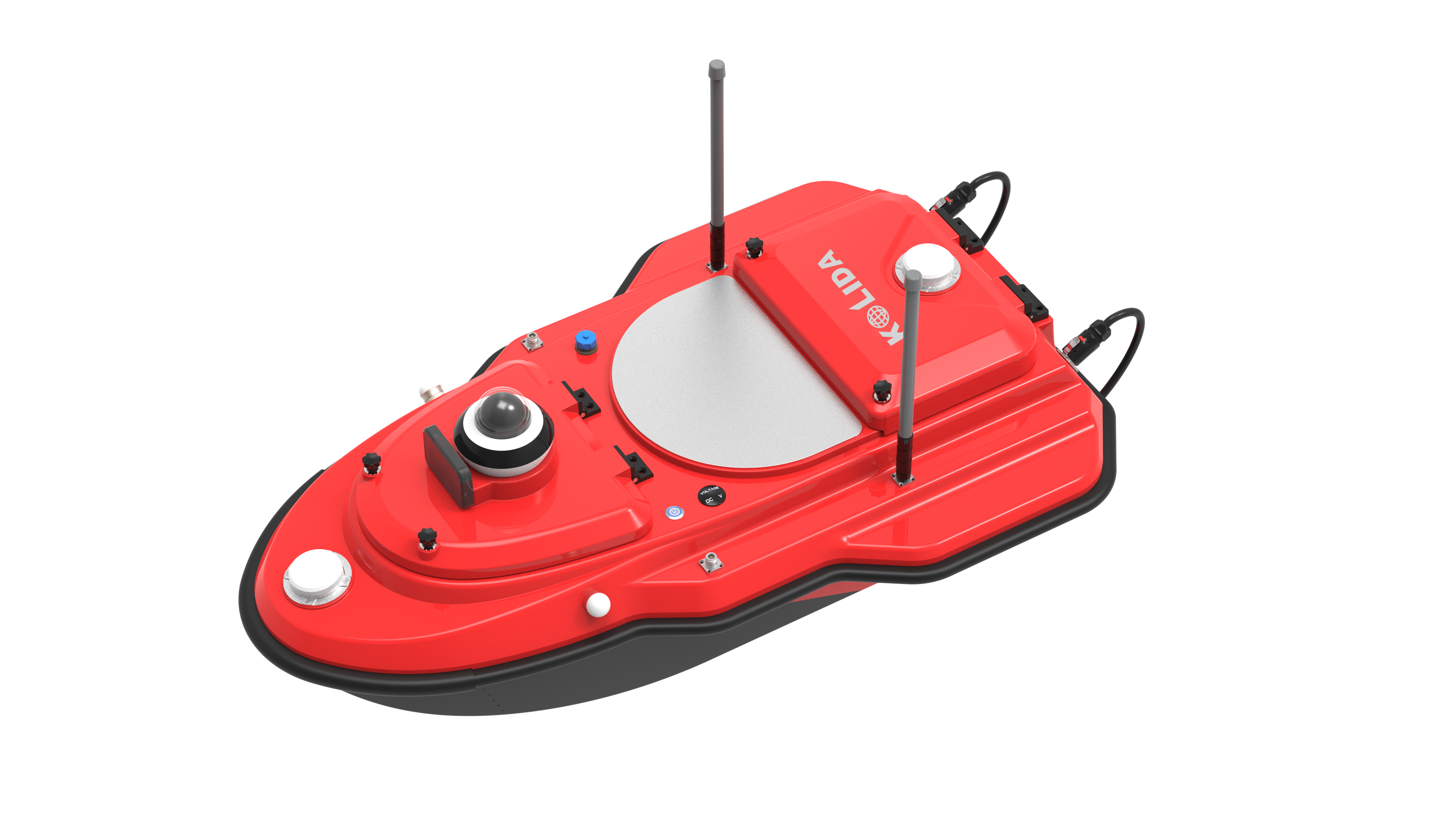
USV AQUA

• Unmanned Surface Vehicle
• Built for Marine Surveying
• Hydrographic & Bathymetric Mapping
• Autonomous Operation

Pipe & Cable Locator

• Detects Underground Utilities
• Non-invasive Imaging
• High Precision Depth Measurement
• Ideal for Urban Surveying

VR Survey Training System

• World’s First VR Simulated Training
• 1:1 Reality Reconstruction
• Genuine Coordinates
• Immersive Learning Environment

Integrated Solutions

End-to-end systems for complex surveying and monitoring challenges.

Marine & Hydrographic Survey

USVs, Echo Sounders, Side Scan Sonars, and ADCPs for comprehensive underwater mapping and seabed analysis.

Automatic Deformation Monitoring

Real-time structural health monitoring using robotic total stations and GNSS sensors for dams, bridges, and tunnels.

LiDAR & UAV Mapping

High-resolution aerial and terrestrial LiDAR scanning with drones and terrestrial laser scanners for 3D modeling.

Precision Agriculture

Auto-steering systems and GNSS guidance for efficient and accurate farming operations.

Rail & Tunnel Engineering

Track geometry trolleys and automated tunnel scanning systems for infrastructure inspection and maintenance.

GIS & Mapping Software

Comprehensive software kits for data processing, visualization, and GIS integration across all SOUTH instruments.

100+
Countries Served
25+
Years of Innovation
50+
Patents Held
10K+
Units Deployed

Frequently Asked Questions

What is the accuracy of SOUTH RTK systems?

SOUTH RTK systems offer centimeter-level accuracy, typically 8mm + 1ppm horizontal and 15mm + 1ppm vertical under optimal conditions.

Are SOUTH instruments waterproof?

Most SOUTH instruments are rated IP65 or higher, making them dust-tight and protected against water jets, suitable for harsh field environments.

Do you offer software support?

Yes, SOUTH provides comprehensive software kits, firmware updates, and technical support through its global dealer network.

Can I integrate SOUTH devices with third-party software?

Yes, SOUTH instruments support standard data formats (e.g., RINEX, DXF, LAS) and can integrate with major GIS and CAD platforms.

Get in Touch

For product inquiries, technical support, or partnership opportunities, visit the official SOUTH website.

Visit Official Website to Contact

Notice for Buyers: If you are a buyer, the above information is generated by AI collection and does not constitute any advice. If necessary, please visit the corresponding official website.

For Domain Owners: If you are the domain owner and do not want to be included by fobcompany.info, please contact support@fobcompany.info via your corporate email to cancel. We will cancel your inclusion within 3 business days.

如果您是域名所有者 不想被fobcompany.info收录 请用企业邮箱联系support@fobcompany.info 取消收录 我们将在3个工作日取消您的收录

Service Request: If you are other domain and want to be included, please contact support@fobcompany.info

如果您是其他域名合作 也请联系support@fobcompany.info